India Backs UN Resolution Promoting a New World Map Projection
News Mania Desk/ Piyal Chatterjee/ 6th September 2026

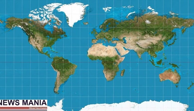
India has voted in favour of a United Nations General Assembly resolution supporting the adoption of a new approach to depicting the world map, aimed at presenting the relative sizes of continents more accurately. The resolution, known as the “Correct the Map” initiative, was adopted by an overwhelming majority at the UN General Assembly. It received 164 votes in favour, while one country voted against it and six abstained. India was among the countries backing the measure.
The resolution encourages the use of equal-area map projections, including the Equal Earth projection, which is designed to represent the actual relative size of landmasses more accurately than some widely used alternatives.
The debate over world map projections has continued for decades because transforming the three-dimensional surface of the Earth onto a flat map inevitably produces distortions. The Mercator projection, one of the most commonly recognised map formats, preserves directions and has historically been particularly useful for navigation. However, it can make areas closer to the poles appear substantially larger than their actual size.
Africa is among the regions most affected by this distortion. Although the continent is considerably larger than many countries and regions commonly shown prominently on world maps, conventional projections can give viewers an inaccurate impression of its scale.
The Equal Earth projection seeks to address this issue by preserving the relative area of different regions. Supporters of the initiative argue that maps influence how people understand geography and that more accurate visual representations can improve geographical education and public awareness.
The UN resolution, however, does not make the new projection mandatory or prohibit the use of the Mercator system. The measure is non-binding and primarily encourages governments, educational institutions and other organisations to consider equal-area projections when representing geographical information.
The adoption of the resolution marks an effort by the international community to promote a more balanced visual representation of the planet. Advocates say the move is particularly significant for education, where world maps are widely used to shape students’ understanding of the relative size and location of continents.
India’s support places it among the large majority of UN members backing the initiative. The vote also reflects growing international interest in addressing longstanding geographical distortions in commonly used world maps while recognising that different projections continue to serve different practical purposes.