
Assam’s Annual Deluge: Why the Brahmaputra Keeps Flooding—and What It Will Take to Break the Cycle
Ms.Bornali Biswas ,Editor in Chief/ 6th August 2026

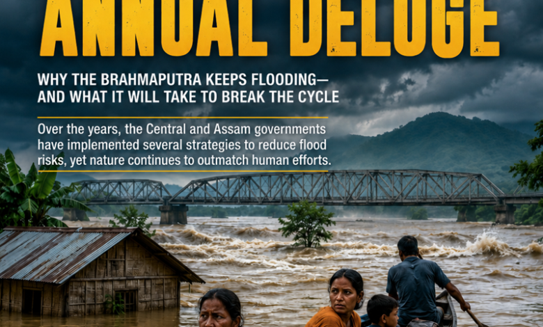
Every year, as dark monsoon clouds gather over Northeast India, the people of Assam prepare for a familiar yet devastating reality. Villages disappear under water, roads and bridges are washed away, crops are destroyed, and thousands of families are forced to leave their homes. What is often described as a “natural disaster” has become an annual humanitarian crisis.
This year has been no different. Floods have claimed dozens of lives and affected hundreds of thousands of people across the state. While heavy monsoon rainfall is the immediate cause, the real story lies in the mighty Brahmaputra River and the fragile ecosystem through which it flows.
The Mighty Brahmaputra
Originating from the glaciers of Tibet as the Yarlung Tsangpo, the Brahmaputra enters India through Arunachal Pradesh before flowing across Assam and eventually into Bangladesh. Stretching nearly 2,900 kilometres, it is one of the world’s largest river systems.
Unlike many rivers that flow through relatively stable plains, the Brahmaputra carries enormous volumes of water and sediment from the young Himalayan mountains. During the monsoon, rainfall across Tibet, Arunachal Pradesh, Assam, Bhutan, and neighbouring regions dramatically increases the river’s discharge.
As dozens of tributaries—including the Subansiri, Manas, Dhansiri, Jia Bharali and Kopili—pour into the Brahmaputra, the river swells rapidly, often overflowing its banks.
Why Assam Floods Every Year
Heavy rainfall alone does not explain Assam’s recurring floods. Several geographical and environmental factors combine to make flooding almost inevitable.
The Brahmaputra carries one of the highest sediment loads of any river in the world. Landslides and erosion in the Himalayas dump millions of tonnes of silt into the river each year. Over time, this sediment raises the riverbed, reducing its capacity to carry floodwaters.
Assam’s valley is relatively flat, preventing water from draining quickly. When intense rainfall occurs upstream, water spreads across the floodplains instead of flowing rapidly downstream.
Deforestation in the Himalayan foothills and catchment areas further worsens the situation. Forests naturally absorb rainfall and reduce runoff. As tree cover declines, rainwater reaches rivers faster, increasing flood peaks.
Climate change has also intensified the challenge. Scientists have observed more frequent extreme rainfall events, erratic monsoon patterns, and accelerated glacial melting in the Himalayas. These changes increase the likelihood of sudden and severe flooding.
The Double-Edged Nature of Floods
Ironically, floods are not entirely harmful.
For centuries, seasonal flooding has replenished Assam’s fertile floodplains with nutrient-rich silt, supporting agriculture and biodiversity. The Brahmaputra has shaped one of India’s richest ecological regions, sustaining wetlands, forests, fisheries, and wildlife, including the famous Kaziranga landscape.
However, increasing population, expanding settlements, and changing climate conditions have transformed beneficial seasonal floods into destructive disasters.
Today, repeated flooding destroys homes, schools, healthcare facilities, roads, power infrastructure, and standing crops. Livestock losses and waterborne diseases further deepen the humanitarian crisis.
The Challenge of River Erosion
Flooding is only part of Assam’s problem.
The Brahmaputra is constantly changing its course, eroding riverbanks and swallowing villages, farmland, and infrastructure. Thousands of hectares of agricultural land disappear every year, forcing families to migrate repeatedly.
River islands, locally known as chars, are among the most vulnerable regions, where residents often lose both homes and livelihoods within a single season.
Can Floods Be Controlled?
Government Measures
Over the years, the Central and Assam governments have adopted multiple strategies to reduce flood risks.
Strengthening Embankments: Thousands of kilometres of embankments have been constructed and reinforced by the Assam Water Resources Department to protect vulnerable districts.
Flood Forecasting: The Central Water Commission operates a network of flood forecasting stations that provide advance warnings, allowing authorities to evacuate residents before rivers reach dangerous levels.
Disaster Response: The National Disaster Response Force and State Disaster Response Force conduct rescue operations using boats, helicopters, and relief camps during major floods.
Early Warning Systems: The Assam State Disaster Management Authority has expanded community-based early warning systems using river gauges, mobile alerts, and local volunteers.
River Management Projects: The Union Government has proposed integrated river basin management, dredging in selected stretches, bank protection works, and scientific studies of sediment transport.
Financial Assistance: Relief funds are provided through the State Disaster Response Fund (SDRF) and National Disaster Response Fund (NDRF), supporting rehabilitation, compensation, and infrastructure restoration.
The Long-Term Solution
Experts agree that embankments alone cannot solve Assam’s flood problem.
A sustainable strategy requires:
- Integrated basin-wide management involving India, Bhutan, China, and Bangladesh.
- Scientific floodplain zoning to prevent unsafe construction.
- Wetland restoration to absorb excess floodwater.
- Afforestation in upstream catchments.
- Better urban drainage systems.
- Climate-resilient agriculture and flood-resistant housing.
- Improved satellite-based forecasting and real-time monitoring.
Experts agree that there is no single solution.
While embankments provide temporary protection, many become vulnerable during extreme floods. Effective flood management requires a combination of engineering, environmental conservation, scientific forecasting, and community preparedness.
Key measures include restoring wetlands, protecting forests, improving drainage systems, strengthening embankments, dredging selected river stretches where scientifically appropriate, expanding flood forecasting networks, and developing climate-resilient infrastructure.
Satellite monitoring, early warning systems, and better coordination among states sharing the Brahmaputra basin can significantly reduce the loss of life.
Equally important is long-term planning that discourages unplanned construction in highly flood-prone areas and promotes resilient housing and agriculture.
Living with the River
The Brahmaputra is both Assam’s greatest blessing and its greatest challenge. It sustains millions of people through agriculture, fisheries, transport, and biodiversity, yet its immense power continues to reshape lives every monsoon.
As climate change increases the frequency of extreme weather events, Assam’s flood problem is likely to become even more complex. The question is no longer whether floods can be completely prevented—they cannot. Instead, the focus must shift toward learning to live with the river through smarter planning, stronger infrastructure, ecological restoration, and disaster preparedness.
Only by understanding the Brahmaputra as a living, dynamic river system—not merely a waterway to be controlled—can Assam hope to reduce the devastation that returns with every monsoon while preserving the lifeline that has sustained the region for centuries.
References
National Remote Sensing Centre (ISRO)
Central Water Commission (Flood Forecasting)
Assam State Disaster Management Authority
National Disaster Management Authority